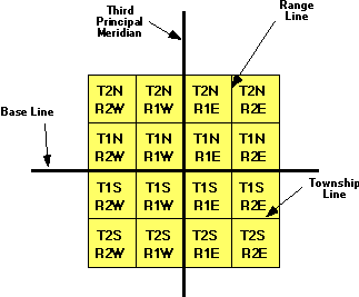
The largest grouping is the township which is named in
reference to a Principal Meridian (P.M.) and
a Baseline. T2N, R1E refers to Township 2 North (of the
Baseline), Range 1 East (of the Principal Meridian).
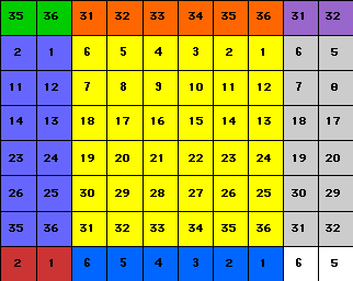
Within each township are 36 sections, each one mile square.
Each section contains 640 acres.
The sections are numbered from 1 to 36 in the following
order.
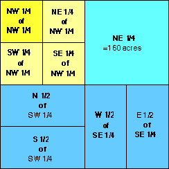
Within each section, the land is refered to as half and
quarter sections. A one-sixteenth division is called a
quarter of a quarter, as in the NE1/4 of the NW1/4. The
descriptions are read from the smallest division to
the largest.
|
|